OUTLOOK ON WESTER ROSS the website of Jeremy Fenton
The Great Wilderness
The name is new but suitable, although some may comment that there is no such thing as large-
“Great”? Yes, certainly. It is a magnificent complex of hills, crags, lochs and glens; there is nothing else like it in the country (the Cairngorms perhaps come closest). It includes:
- In the north, An Teallach, a rival of Liathach for the title of best Scottish hill.
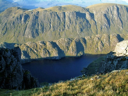
- In the south, Slioch, the eye-
catching tower above Loch Maree (itself thought by many to be the finest Scottish loch).
- In the centre, A’ Mhaighdean, a hill with the best mountaintop view in the country.
- Beinn Lair’s 3 miles of cliffs and buttresses, the longest line of inland cliffs in the UK.
- Hills and cliffs made of all three local mountain-
building rocks: gneiss, sandstone and amphibolite. - 8 Munros and 6 Corbetts, including the remotest Munro (Ruadh-
Stac Mor).
There are four access points. Two bothies are well placed to cover the area, at Shenavall and Carnmore. But a tent is better! Many 2/3-
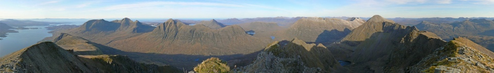
Rather than looking at each hill separately, this selection of photographs takes a tour around the Great Wilderness.
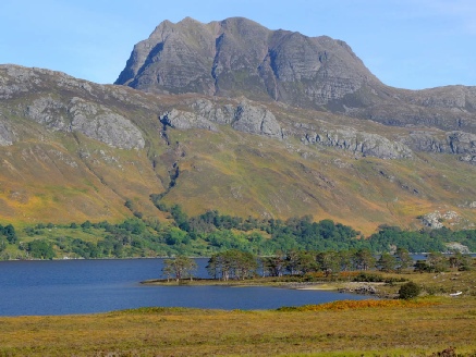
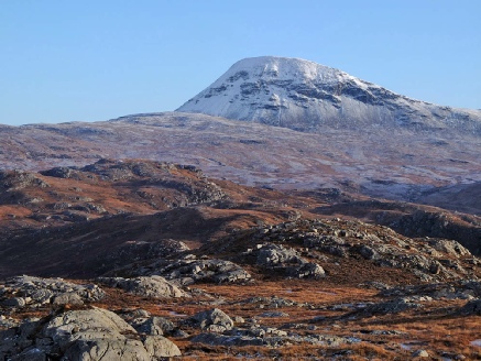
Let’s start with Slioch (981m):the classic view from Loch Maree of the formidable SW face.
The climb starts from Kinlochewe, and makes use of the huge corrie which hides behind the face: long but not difficult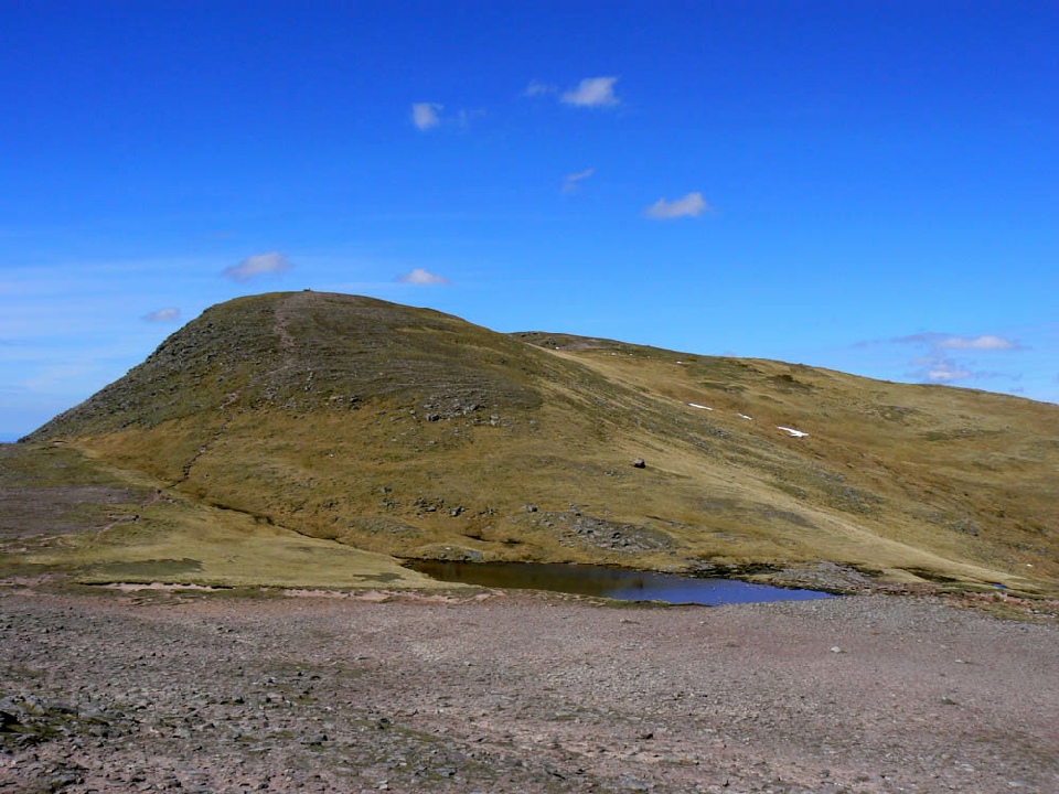 .
.
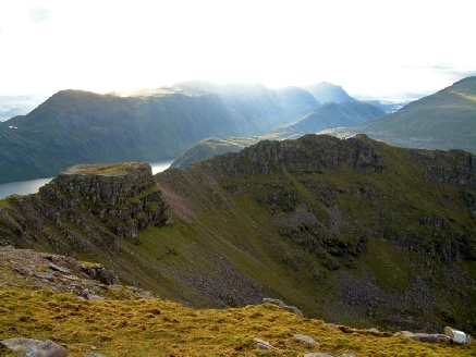
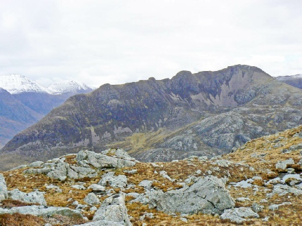
Slioch’s neighbour above Loch Maree is Beinn Lair (859m). From this side it looks rather bland, but...
The further side is a 3-
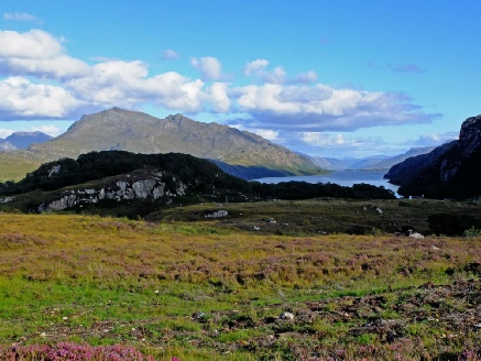
Beinn Lair is the first of three amphibolite hills forming a broken ridge between Fionn Loch (right) and Loch Maree. Seen beyond it are Meall Mheinnidh (722m) and Beinn Airigh Charr (791m).
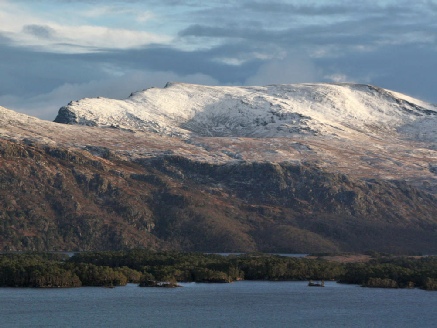
Distinctively shaped, Beinn Airigh Charr is better known as the backdrop to Poolewe and Inverewe. Here Loch Maree is seen to its right.
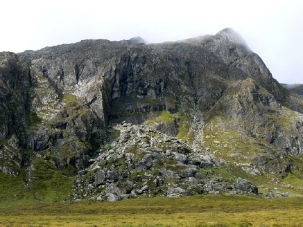
Like Beinn Lair, Beinn Airigh Charr has an impressive NE face, with a huge rockfall below it.
Its summit gives a view of our next hill, in the centre of the Great Wilderness.
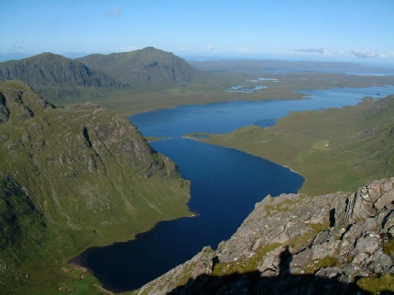
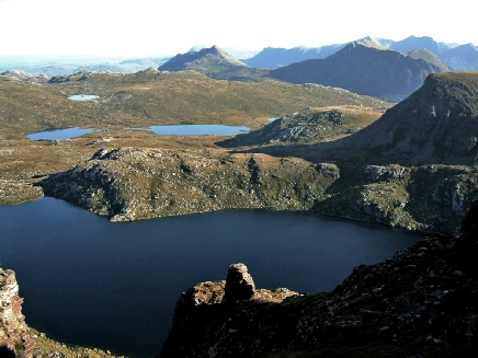
The reverse of the previous view, from A’ Mhaighdean, the Maiden (967m): Dubh Loch and Fionn Loch, separated by an artificial causeway; Loch Ewe in the distance.
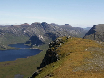
The views from A’ Mhaighdean are unsurpassed: here part of Beinn Lair is seen above the remarkable Beinn Tharsuinn Chaol ridge, and dark Gorm Loch Mor.
A third direction: north from A’ Mhaighdean with Fuar Loch Mor, and the Deargs beyond.
The wonderful NW ridge gives the best approach, including these tricky and unexpected sandstone towers (on a gneiss hill).
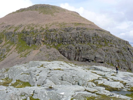
In this view from Beinn a’ Chaisgein Mor (854m), gneiss A’ Mhaighdean (right) is contrasted with its sandstone neighbour, Ruadh Stac Mor (918m, left), the remotest Munro.
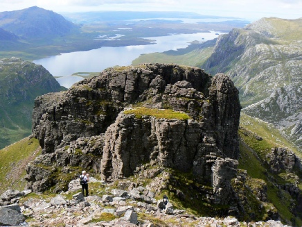
Beinn a’ Chaisgein Mor is a big lumpish hill seen from the Loch Ewe area, but has two extraordinary crags on its side: Carnmore Crag above Carnmore Lodge, and Sgurr na Laocainn.
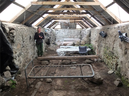
Near Carnmore Lodge a former byre is available as a primitive bothy...
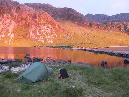
But you may prefer to sleep in a tent, as here at the causeway with Beinn Lair showing as the most distant of a series of cliffs.
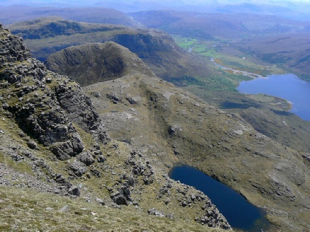
Ruadh Stac Mor from the col between it and A’ Mhaighdean. The contrast between gneiss and sandstone is obvious.
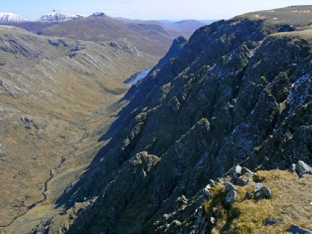
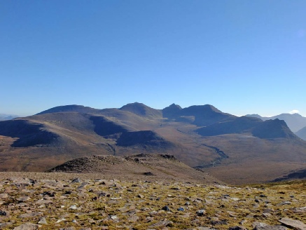
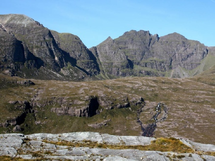
The eastern edge of the Great Wilderness is formed by a group of four hills. Here Beinn Lair is seen beyond Lochan Fada from Beinn Tarsuinn (937m), a narrow sandstone ridge.
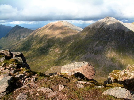
The other three hills from Beinn Tarsuinn: (right to left) Mullach Coire Mhic Fhearchair (1019m), Sgurr Ban (989m), Beinn a’ Chlaidheimh (913m). Rather too much quartzite?
MCMF has a surprising east ridge: it is not easy, being made of crumbly gneiss. Why crumbly? Because it has been pushed up to this height and damaged by the Moine Thrust.
North of Ruadh Stac Mor is a very fine sandstone hill: Beinn Dearg Mor (910m). Here its “back” is seen from Sgurr Ban.
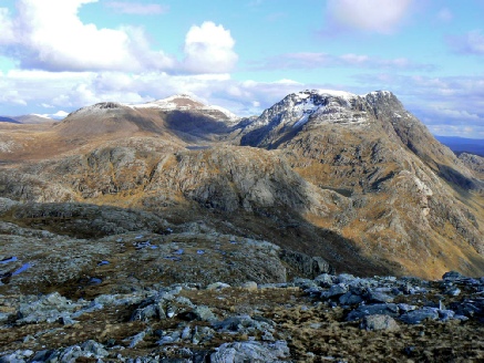
The front of the hill is well viewed from An Teallach: the summit elegantly flanked by two steep ridges.
Beinn Dearg Beag (818m) is the smaller brother of Beinn Dearg Mor: an enjoyable sandstone ridge on a base of gneiss.
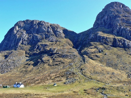
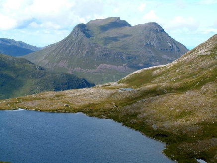
The northernmost hill in the Great Wilderness is Sail Mhor (767m), known as the Plum Pudding because of its shape.
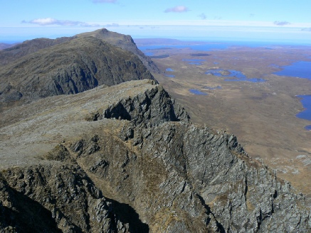
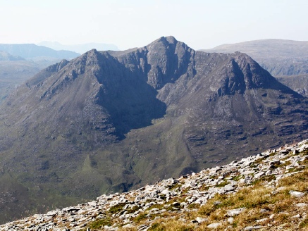
Sail Mhor gives a view of the final, highest and greatest hill of the Great Wilderness, An Teallach (1062m).
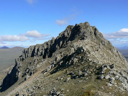
An Teallach’s Coire Toll an Lochan has as its headwall the famous Corrag Bhuidhe pinnacles and Sgurr Fiona.
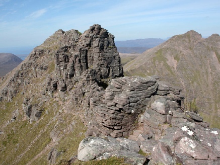
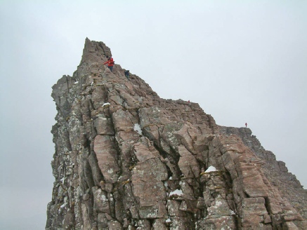
These pinnacles give an exhilarating scramble, difficult in places. Beyond them is Sgurr Fiona, and to the right the main summit.
Lord Berkeley’s Seat is above a high overhanging wall; who was Lord Berkeley and why did he sit there?
That gives some idea of the GW, but it is of course better in the flesh. Don’t waste it on bad weather (that’s easily said when I live close to it: those who drive long distances may have less choice!). And don’t rush it. There is an annual charity walk/run across it from Dundonnell to Poolewe (all on paths except for two river crossings), in one day; and some people climb A’ Mhaighdean in a long day from Poolewe (I’ve done it once). No! Take a tent or a bivouac bag and just enjoy wandering.
By the way, the excellent Access Law which Scotland now enjoys owes much to Paul van Vlissingen, the late (Dutch) landowner of much of the GW (Letterewe and Fisherfield), who allowed free access to his land under “the Letterewe Accord”; this became the model for our legislation.
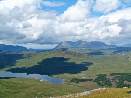
An Teallach, as it is isolated, stands out in many views: here from the Fannichs, east of the Moine Thrust.
Here you can just see (top right) the other bothy, Shenavall, at the foot of An Teallach in Strath na Sealga.